Daily gridded climate data
URL: https://opendata.meteo.be/geonetwork/srv/eng/catalog.search#/metadata/RMI_DATASET_GRIDDEDOBS
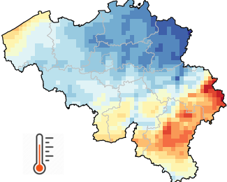
The climate grids result from the spatial interpolation of observations. The interpolation method is adapted to each variable and temporal resolution. When possible, the involved statistical procedures integrate highly correlated ancillary data in addition to the observations. To cite a few examples, air temperature is affected by several factors such as the terrain elevation and the proximity of water surfaces. Solar radiation is mainly driven by cloud cover which can be characterized by Meteosat satellite data.
Access the data at the RMI open data portal ('Select a product' > 'Daily gridded climate data - only for academic users')
Additional Information
| Field | Value |
|---|---|
| Format | CSV |
| Created | 9 March 2026 |
| Last Updated | 19 May 2026 |
| Package identifier | 35e765b6-2449-4d0d-b749-d76511e8cb85 |
| URI | https://opendata.meteo.be/geonetwork/srv/eng/catalog.search#/metadata/RMI_DATASET_GRIDDEDOBS |